AR Sandbox
Services
![]() AR Sandbox
AR Sandbox
Services
![]() AR Sandbox
AR Sandbox
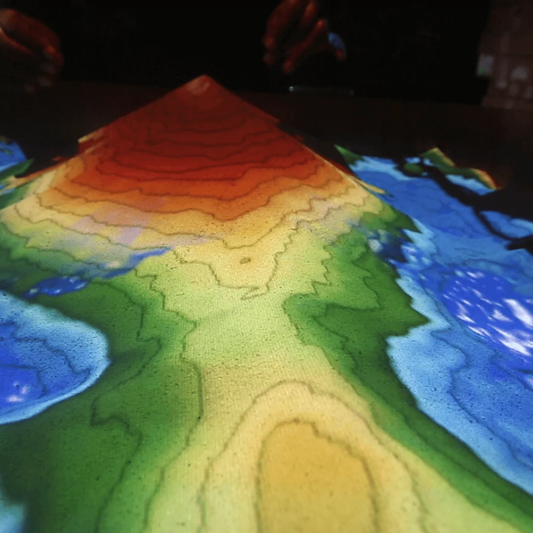
The Augmented Reality (AR) Sandbox combines 3D visualization applications with a hands-on sandbox exhibit to teach earth science concepts. The AR sandbox allows users to create topography models by shaping real sand, which is then augmented in real time by an elevation color map, topographic contour lines, and simulated water.
The system teaches geographic, geologic, and hydrologic concepts such as how to read a topographic map, the meaning of contour lines, watersheds, catchment areas, levees, etc. as well as mathematical and physics concepts such as bearings, graphs, geometry, trigonometry, vectors, measurement, forces, kinetic theory and more.
The entire sandbox has dimensions of 79”H x 41.5”W x 33.5”L. It is supported by 3” swivel caster wheels to allow for ease of mobility, shelves for immediate storage and a secure storage space. The Sandbox uses a BenQ MX632ST projector which has a brightness of 3,200 ANSI Lumens with up to 10,000 hour lamp life and a contrast ratio of 13000:1 which allows for clear usage in moderately lit rooms.